
Day - 06 Wednesday. I meet someone.
Today I planned to follow the south bank of the river as best I could down to the bridge at Poulary where I would cross over and make my way down to Tomdoun where I hoped there was a parcel waiting for me. I’d then follow the road down to Loch Garry, cross another bridge, make my way up to the bealach between Ben Tee and Meall a Choire Ghlais, and then drop down to make camp just before the Great Glen.

I was up at eight and away at nine thirty, down the river bank and then along the forestry track. I had planned to follow the path shown dropping down to the river again, and following this down to the bridge over the River Garry, but I didn’t see this path and found myself following the forestry track all the way to the bridge, where I arrived at 10:45.
I was surprised at the volume of water coming down the River Garry as the other rivers I’d seen had been low due to low rainfall during the past few weeks, but I guess they had the turbines running in the hydro power station at Loch Quoich higher up the river.
Crossing the bridge and pulling up a small slope I came to the road, the first I’d seen since Glenelg five days ago. I followed this road eastward and at 11:45 arrived at Tomdoun.
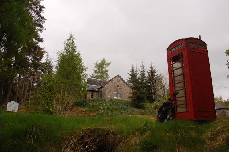
The phone box shown on the map does exist and I tried unsuccessfully to ring up Challenge control and home. No mobile signal either. I walked up to the Tomdoun Hotel which was a more ramshackle affair than the website leads you to believe. Good.
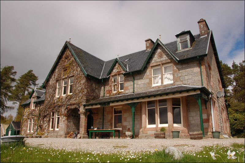
The owner was just driving up as I arrived and he welcomed me in as if my arrival was exactly what he’d been hoping for. It wasn’t lunch time but he agreed to get me some scrambled eggs on toast, something I’d discovered were just the thing last year at Edzell. To follow he made me a massive jug of hot chocolate and let me use the phone. He also had a parcel for me which I sorted out on the front veranda where there was a peculiar assortment of furniture. I told him I’d seen a pair of osprey and he asked if I’d seen the wild boar. Apparently there were several, including an unfriendly large male living in the area where I had camped.
I carried on along the road, pausing to take a photo showing a sign pointing (in a vague sort of way) to the Garry Gualach ferry. All I can find out about this is that there used to be a foot ferry across the River Garry to Garry Gualach, but why there was a need for a ferry here, what sort of boat and how long ago remains a mystery. [March 2011. John Donohoe tells me that "The ferry near Tomdoun was a foot ferry over to Garrygualach which was at one time an outdoor centre. Like others of that ilk aspirant travellers had to signal over to attract the boatman's attention."]

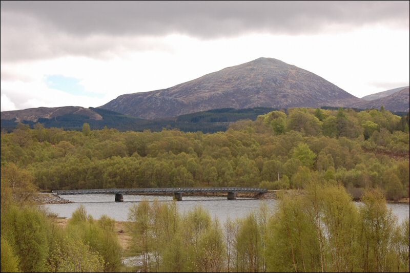
Just before the bridge across Loch Garry I stopped to take a photo of the bridge with Ben Tee behind. Bridge and Tee seemed appropriate as I was reading Mapp and Lucia in the evenings.
I followed tracks through Greenfield and then stopped at the Allt Ladaidh for something to eat. A hundred metres further on I came across an excellent hut for a snack and wished I had stopped there,

but I carried on, to the south now, up the track towards Ben Tee. Once again the occasional bite of flapjack kept me going nicely, although I did have to stop now and again to cool off, it had been overcast most of the day, but now the sun was coming out and it was hot.
I reached the bealach between Ben Tee and Maell a Choire Ghlais at five. My vetter (Colin Crawford) had suggested that I was now well placed to take in either or both of these peaks, but I didn’t feel inclined to do that in this muggy heat this late in the day. Instead I found myself trying to find my way across a boggy bealach. I was pleasantly surprised to find the way was marked with canes stuck into the peat, and these led me most of the way across, but then they seemed to lead to, and then abandon me, in a particularly soft bit of bog. Carelessness on my part or an elaborate Highland practical joke?
I veered off to the drier southern slopes of Ben Tee, then kept above the boggy ground until the river was in an obvious valley and I was able to drop down to the Allt a Choire Ghlais and find a good place to rest and eat.
Setting off down the valley I found that it was narrowing into a gorge and I was finding myself on increasingly steep slopes, so steep in fact that I was scared and had no alternative but to climb back and up to safer ground. I also found a path which was good, particularly as I soon came to deer fence which would have been difficult with no stile, but I was now hundreds of feet above the river which I was hoping to camp beside.

However, having no real alternative I followed the path down to just above Kilfinnan where there was a flat piece of ground beside the river which would just about take the tent. I decided to have dinner (Mountain House Chicken Korma for two) and decide what to do. Although it was after 8pm I decided to move on as it wasn’t a good spot and was too near the farm. I made my way down the track which runs along the shore of Loch Long until I found a flat spot between the track and the loch. It was stony and had the remains of old dry brambles, but I was too tired to carry on so put the tent up and went straight to bed (10pm). The worst camp spot of the trip.
Day 07 Intro